This article is about the Nepalese earthquake that happened on 25 April 2015. For the major aftershock on 12 May 2015, see May 2015 Nepal earthquake.
2015 Nepal earthquake 
Kathmandu


Date 25 April 2015 Origin time 11:56:26 NST Magnitude 7.8Mw or 8.1 Ms Depth 8.2 km (5.1 mi) Epicenter 28°08′49″N 84°42′29″E / 28.147°N 84.708°ECoordinates: 28°08′49″N 84°42′29″E / 28.147°N 84.708°E Type Thrust Areas affected Total damage ≈$5 billion (about 25% of GDP) Max. intensity IX (Violent) Aftershocks 7.3Mw on 12 May at 12:51
6.7Mw on 26 April at 12:54No. of aftershocks( >=4ML )=379 (as of 16 August 2015)Casualties 8,857 dead in Nepal (officially) and 9,018 in total 21,952 injured (officially)

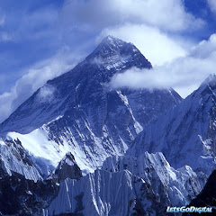
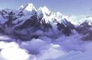
The April 2015 Nepal earthquake (also known as the Gorkha earthquake) killed more than 9,000 people and injured more than 23,000. It occurred at on 25 April, with a magnitude of 7.8Mw or 8.1Ms and a maximum Mercalli Intensity of IX (Violent). Its epicenter was east of the district of Lamjung, and its hypocenter was at a depth of approximately 8.2 km (5.1 mi). It was the worst natural disaster to strike Nepal since the 1934 Nepal–Bihar earthquake. The earthquake triggered an avalanche on Mount Everest, killing at least 19, making April 25, 2015 the deadliest day on the mountain in history. The earthquake triggered another huge avalanche in the Langtang valley, where 250 people were reported missing.
Hundreds of thousands of people were made homeless with entire villages flattened, across many districts of the country. Centuries-old buildings were destroyed at UNESCO World Heritage sites in the Kathmandu Valley, including some at the Kathmandu Durbar Square, the Patan Durbar Square, the Bhaktapur Durbar Square, the Changu Narayan Temple and the Swayambhunath Stupa. Geophysicists and other experts had warned for decades that Nepal was vulnerable to a deadly earthquake, particularly because of its geology, urbanization, and architecture.
Continued aftershocks occurred throughout Nepal at the intervals of 15–20 minutes, with one shock reaching a magnitude of 6.7 on 26 April at NST. The country also had a continued risk of landslides.
A major aftershock occurred on 12 May 2015 at with a moment magnitude (Mw) of 7.3 The epicenter was near the Chinese border between the capital of Kathmandu and Mt. Everest.More than 200 people were killed and more than 2,500 were injured by this aftershock.
Contents
- 1 Earthquake
- 2 Geology
- 2.1 Intensity
- 2.2 Aftershocks
- 2.3 12 May 2015 earthquake
- 3 Aftermath
- 3.1 Casualties
- 3.1.1 Avalanches on Mount Everest
- 3.1.2 Landslides in the Langtang Valley
- 3.2 Damage
- 3.3 Economic loss
- 3.4 Social effects
- 3.5 Minorities/Racial Element
- 3.6 Media coverage
- 3.1 Casualties
- 4 Rescue and relief
- 5 Repair and reconstruction
- 5.1 Monuments
- 6 International aid
- 7 See also
- 8 References
Earthquake
Map of the earthquake and aftershocks at 2 May, showing location of major historical arthquakes
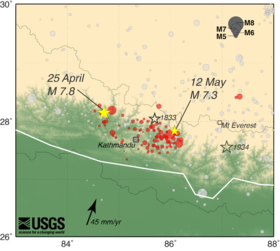
The earthquake occurred on 25 April 2015 at NST (06:11:26 UTC) at a depth of approximately 15 km (9.3 mi) (which is considered shallow and therefore more damaging than quakes that originate deeper in the ground), with its epicentre approximately 34 km (21 mi) east-southeast of Lamjung, Nepal, lasting approximately fifty seconds. The earthquake was initially reported as 7.5 Mw by the United States Geological Survey (USGS) before it was quickly upgraded to 7.8 Mw. The China Earthquake Networks Center (CENC) reported the earthquake's magnitude to be 8.1 Ms. The India Meteorological Department (IMD) said two powerful quakes were registered in Nepal at 06:11 UTC and 06:45 UTC. The first quake measured 7.8 Mw and its epicenter was identified at a distance of 80 km to the northwest of Kathmandu, the capital of Nepal. Bharatpur was the nearest major city to the main earthquake, 53 km (33 mi) from the epicenter. The second earthquake was somewhat less powerful at 6.6 Mw. It occurred 65 km (40 mi) east of Kathmandu and its seismic focus lay at a depth of 10 km (6.2 mi) below the earth's surface. Over thirty-eight aftershocks of magnitude 4.5 Mw or greater occurred in the day following the initial earthquake, including the one of magnitude 6.8 Mw.
According to the USGS, the temblor was caused by a sudden thrust, or release of built-up stress, along the major fault line where the Indian Plate, carrying India, is slowly diving underneath the Eurasian Plate, carrying much of Europe and Asia. Kathmandu, situated on a block of crust approximately 120 km (74 miles) wide and 60 km (37 miles) long, reportedly shifted 3 m (10 ft) to the south in a matter of just 30 seconds.
The risk of a large earthquake was well known beforehand. In 2013, in an interview with seismologist Vinod Kumar Gaur, The Hindu quoted him as saying, "Calculations show that there is sufficient accumulated energy [in the Main Frontal Thrust], now to produce an 8 magnitude earthquake. I cannot say when. It may not happen tomorrow, but it could possibly happen sometime this century, or wait longer to produce a much larger one." According to Brian Tucker, founder of a nonprofit organization devoted to reducing casualties from natural disasters, some government officials had expressed confidence that such an earthquake would not occur again. Tucker recounted a conversation he had had with a government official in the 1990s who said, "We don't have to worry about earthquakes anymore, because we already had an earthquake"; the previous earthquake to which he referred occurred in 1934.
Geology

Nepal lies towards the southern limit of the diffuse collisional boundary where the Indian Plate underthrusts the Eurasian Plate, occupying the central sector of the Himalayan arc, nearly one-third of the 2,400 km (1,500 mi) long Himalayas. Geologically, the Nepal Himalayas are sub-divided into five tectonic zones from north to south, east to west and almost parallel to sub-parallel. These five distinct morpho-geotectonic zones are: (1) Terai Plain, (2) Sub Himalaya (Sivalik Range), (3) Lesser Himalaya (Mahabharat Range and mid valleys), (4) Higher Himalaya, and (5) Inner Himalaya (Tibetan Tethys). Each of these zones is clearly identified by their morphological, geological, and tectonic features.
The convergence rate between the plates in central Nepal is about 45 mm (1.8 in) per year. The location, magnitude, and focal mechanism of the earthquake suggest that it was caused by a slip along the Main Frontal Thrust.
The earthquake's effects were amplified in Kathmandu as it sits on the Kathmandu Basin, which contains up to 600 m (2,000 ft) of sedimentary rocks, representing the infilling of a lake.
Based on a study published in 2014, of the Main Frontal Thrust, on average a great earthquake occurs every 750 ± 140 and 870 ± 350 years in the east Nepal region. A study from 2015 found a 700-year delay between earthquakes in the region. The study also suggests that because of tectonic stress buildup, the earthquake from 1934 in Nepal and the 2015 quake are connected, following a historic earthquake pattern.
Intensity

According to "Did You Feel It?" (DYFI?) responses on the USGS website, the intensity in Kathmandu was IX (Violent) Tremors were felt in the neighboring Indian states of Bihar, Uttar Pradesh, Assam, West Bengal, Sikkim, Jharkhand, Uttarakhand, Gujarat in the National capital region around New Delhi and as far south as Karnataka. Many buildings were brought down in Bihar. Minor cracks in the walls of houses were reported in Odisha. Minor quakes were registered as far as Kochi in the southern state of Kerala. The intensity in Patna was V (Moderate). The intensity was IV (Light) in Dhaka, Bangladesh. The earthquake was also experienced across southwestern China, ranging from the Tibet Autonomous Region to Chengdu, which is 1,900 km (1,200 mi) away from the epicenter. Tremors were felt in Pakistan and Bhutan.
Aftershocks
Main article: List of aftershocks after the 2015 Nepal earthquake
A major aftershock of magnitude 6.7 Mw occurred on 26 April 2015 in the same region at 12:55 NST (07:09 UTC), with an epicenter located about 17 km (11 mi) south of Kodari, Nepal. The aftershock caused fresh avalanches on Mount Everest and was felt in many places in northern India including Kolkata, Siliguri, Jalpaiguri and Assam. The aftershock caused a landslide on the Koshi Highway which blocked the section of the road between Bhedetar and Mulghat
A model of GeoGateway, based on a United States Geological Survey mechanism of a near-horizontal fault as well as location of aftershocks showed that the fault was an 11° dip striking at 295°, 50 km (31 mi) wide, 150 km (93 mi) long, and had a dip slip of 3 m (9.8 ft). The USGS says the aftershock registered at a shallow depth of 10 km (6.2 mi).
Assuming that 25 April earthquake was the largest event in this seismic episode, Nepal could expect more than 30 aftershocks greater than magnitude 5 over the following month. As of 2 September 2015, 386 aftershocks had occurred with different epicenters and magnitudes equal to or above 4 Mw (out of which 51 aftershocks are equal to or above 5 Mw) and more than 20,000 aftershocks less than 4 Mw.
12 May 2015 earthquake
Main article: May 2015 Nepal earthquake
A second major earthquake occurred on 12 May 2015 at 12:51 NST with a moment magnitude (Mw) of 7.3Mw 18 km (11 mi) southeast of Kodari. The epicenter was near the Chinese border between the capital of Kathmandu and Mt. Everest. It struck at the depth of 18.5 km (11.5 miles). This earthquake occurred along the same fault as the original magnitude 7.8 earthquake of 25 April but further to the east. As such, it is considered to be an aftershock of the 25 April quake. Tremors were also felt in northern parts of India including Bihar, Uttar Pradesh, West Bengal and other North-Indian States.
At least 153 died in Nepal as a result of the aftershock and about 2,500 were injured. 62 others died in India, two in Bangladesh, and one in China.
Aftermath
Disastrous events in very poor and politically paralyzed nations such as Nepal often become a long drawn out chain of events, in that one disaster feeds into another for years or even decades upon end. The after effects from the earthquake have knock-on effects on a myriad seemingly unrelated aspects: human trafficking, labour cost and availability, rental and property cost burdens, urbanization, private and public debt burdens, mental health, politics, tourism, as well as disease and healthcare system damages, disasters that come with the monsoon season. The first monsoon related effects: a landslip on 11 June claimed 53 lives meanwhile a glacial lake had burst in particularly hard hit Solukhumbhu district;[56] whether or not the quake had contributed to such events is often unknown and unresearched, but certainly possible.| Country | Deaths | Injuries | Ref. |
|---|---|---|---|
| > 8,857 | > 22,304 | ||
| 130 | 560 | ||
| 27 | 383 | ||
| 4 | 200 | ||
| Total | 9,018 | 23,447 |
| Country | Deaths | Ref. |
|---|---|---|
| 40 | ||
| 10 | ||
| 7 | ||
| 7 | ||
| 5 | ||
| 4 | ||
| 4 | ||
| 2 | ||
| 2 | ||
| 1 | ||
| 1 | ||
| 1 | ||
| 1 | ||
| 1 | ||
| 1 | ||
| 1 | ||
| 1 | ||
| Total | 89 |
Casualties
- Nepal
The earthquake killed more than 8,800 in Nepal and injured more than twice as many. The rural death toll may have been lower than it would have been as the villagers were outdoors, working when the quake hit. As of 15 May, 6,271 people, including 1,700 from the 12 May aftershock, were still receiving treatment for their injuries. More than 450,000 people were displaced.
The Himalayan Times reported that as many as 20,000 foreign nationals may have been visiting Nepal at the time of the earthquake, although reports of foreign deaths were relatively low.
- India
A total of 130 deaths were reported in India - including 58 in Bihar, 16 in Uttar Pradesh, 3 in West Bengal and 1 in Rajasthan
- China
27 dead and 4 missing, all from the Tibet Autonomous Region
- Bangladesh
4 dead.
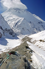
Avalanches on Mount Everest
Main article: 2015 Mount Everest avalanches
This earthquake caused avalanches on Mount Everest. At least 19 died, including Google executive Dan Fredinburg, with at least 120 others injured or missing.
Landslides in the Langtang Valley
In the Langtang valley located in Langtang National Park, 329 people were reported missing after an avalanche hit the village of Ghodatabela[88 and the village of Langtang. The avalanche was estimated to have been two to three kilometres wide. Ghodatabela was an area popular on the Langtang trekking route.[90] The village of Langtang has been destroyed by the avalanche. Smaller settlements on the outskirts of Langtang were buried during the earthquake, such as Chyamki, Thangsyap, and Mundu. Twelve locals and two foreigners were believed to have survived. Smaller landslides occurred in the Trishuli River Valley with reports of significant damage at Mailung, Simle, and Archale.[16][91][92] On 4 May it was announced that 52 bodies had been found in the Langtang area, of which seven were of foreigners.[93]
Damage
Thousands of houses were destroyed across many districts of the country, with entire villages flattened, especially those near the epicenter.[15][17][18] The Tribhuvan International Airport serving Kathmandu was closed immediately after the quake, but was re-opened later in the day for relief operations and, later, for some commercial flights.[94] It subsequently shut down operations sporadically due to aftershocks,[95] and on 3 May was closed temporarily to the largest planes for fear of runway damage.[96] Many workers were not at their posts, either from becoming earthquake casualties or because they were dealing with its after effects.[97] Flights resumed from Pokhara, to the west of the epicentre, on 27 April.[98]


Several of the churches in the Kathmandu valley were destroyed. As Saturday is the principal day of Christian worship in Nepal, 500 people were reported to have died in the collapses.[99][100]
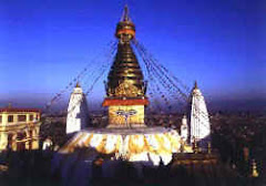
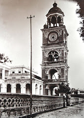
Several pagodas on Kathmandu Durbar Square, a UNESCO World Heritage Site, collapsed,[26] as did the Dharahara tower, built in 1832; the collapse of the latter structure killed at least 180 people,[101][102][103][104] Manakamana Temple in Gorkha, previously damaged in an earlier quake, tilted several inches further. The northern side of Janaki Mandir in Janakpur was reported to have been damaged.[105] Several temples, including Kasthamandap, Panchtale temple, the top levels of the nine-story Basantapur Durbar, the Dasa Avtar temple and two dewals located behind the Shiva Parvati temple were demolished by the quake. Some other monuments including the Taleju Bhawani Temple partially collapsed.[106][107]
The top of the Jaya Bageshwari Temple in Gaushala and some parts of the Pashupatinath Temple, Swyambhunath, Boudhanath Stupa, Ratna Mandir, inside Rani Pokhari, and Durbar High School have been destroyed.[108]
In Patan, the Char Narayan Mandir, the statue of Yog Narendra Malla, a pati inside Patan Durbar Square, the Taleju Temple, the Hari Shankar, Uma Maheshwar Temple and the Machhindranath Temple in Bungamati were destroyed. In Tripureshwar, the Kal Mochan Ghat, a temple inspired by Mughal architecture, was completely destroyed and the nearby Tripura Sundari also suffered significant damage. In Bhaktapur, several monuments, including the Fasi Deva temple, the Chardham temple and the 17th century Vatsala Durga Temple, were fully or partially destroyed.[108]
Outside the Valley, the Manakamana Temple in Gorkha, the Gorkha Durbar, the Palanchok Bhagwati, in Kabhrepalanchok District, the Rani Mahal in Palpa District, the Churiyamai in Makwanpur District, the Dolakha Bhimsensthan in Dolakha District, and the Nuwakot Durbar suffered varying degrees of damage. Historian Prushottam Lochan Shrestha stated, "We have lost most of the monuments that had been designated as World Heritage Sites in Kathmandu, Bhaktapur and Lalitpur District, Nepal. They cannot be restored to their original states."[108] The northeastern parts of India also received major damage. Heavy shocks were felt in the states Uttrakhand, Uttar Pradesh, West Bengal and others. Huge damage was caused to the property and the lives of the people.
Economic loss

Concern was expressed that harvests could be reduced or lost this season as people affected by the earthquake would have only a short time to plant crops before the onset of the Monsoon rains.[109]
Nepal, with a total Gross Domestic Product of USD$19.921 billion (according to a 2012 estimate),[110] is one of Asia's poorest countries, and has little ability to fund a major reconstruction effort on its own.[111] Even before the quake, the Asian Development Bank estimated that it would need to spend about four times more than it currently does annually on infrastructure through to 2020 to attract investment.[111] The U.S. Geological Survey initially estimated economic losses from the temblor at 9 percent to 50 percent of gross domestic product, with a best guess of 35 percent. "It’s too hard for now to tell the extent of the damage and the effect on Nepal’s GDP", according to Hun Kim, an Asian Development Bank (ADB) official. The ADB said on the 28th that it would provide a USD$3 million grant to Nepal for immediate relief efforts, and up to USD$200 million for the first phase of rehabilitation.[111]

Rajiv Biswas, an economist at a Colorado-based consultancy, said that rebuilding the economy will need international effort over the next few years as it could "easily exceed" USD$5 billion, or about 20 percent of Nepal's gross domestic product.[111][112][not in citation given]
Social effect
It was reported that the survivors were preyed upon by human traffickers involved in supply of girls and women to the brothels of South Asia.[113] The most affected were the poor communities who lost their homes.[114]
Minorities/Racial Elemen

In the bitter fight for supplies, single women have had very little access to post-quakes relief as dropped or handed out supplies are hoarded by males, where rapes and fear of rapes block material aid and healthcare services from reaching them, according to a report by the Inter-party Women’s Alliance (IPWA).[115] Additionally, the earthquake has hit certain minorities, Tibeto-Burman (Oriental) races were hardest hit as they tend to inhabit the higher slopes of mountains as opposed to the central valleys, and thus are harder to access, less educated and connected, and are considered lower caste within Nepali society. Malnutrition in children, where 41 percent of children under five were stunted, 29 percent were underweight and 11 percent were emaciated according to UNICEF before the quake, has worsened considerably some 3 months after the quake according to a survey, with the most undernourished being Tamang and Chepang peoples.[116]
Media coverage
On 3 May, the hashtag #GoHomeIndianMedia was trending worldwide on Twitter condemning news covered by the Indian media as insensitive and inhumane to victims of the tragedy. People of Nepal acknowledged the aid and effort put by the Indian armed forces, yet, at the same time, accused Indian news networks of carrying out "a public relations exercise" on behalf of the Indian government, for patronising aid given as exclusive, and for hogging space on relief planes where aid material or rescue or medical personnel could have been sent instead.[117] Indian users responded with the hashtags #SorryNepal and #DontComeBackIndianMedia.[118]
Rescue and relief
.jpg)
About 90 percent of soldiers from the Nepalese Army were sent to the stricken areas in the aftermath of the earthquake under Operation Sankat Mochan, with volunteers mobilized from other parts of the country.[119] Rainfall and aftershocks were factors complicating the rescue efforts, with potential secondary effects like additional landslides and further building collapses being concerns. Impassable roads and damaged communications infrastructure posed substantial challenges to rescue efforts.[120] Survivors were found up to a week after the earthquake.[121][122][123]
As of 1 May 2015[update], international aid agencies like Médecins Sans Frontières (Doctors Without Borders) and the Red Cross were able to start medically evacuating the critically wounded by helicopter from outlying areas, initially cut-off from the capital city, Kathmandu,[17] and treating others in mobile and makeshift facilities.[124][125] There was concern about epidemics due to the shortage of clean water, the makeshift nature of living conditions and the lack of toilets.[126]
Emergency workers were able to identify four men who had been trapped in rubble, and rescue them, using advanced heartbeat detection. The four men were trapped in up to ten feet of rubble in the village of Chautara, north of Kathmandu. An international team of rescuers from several countries using FINDER devices found two sets of men under two different collapsed buildings.[127]
Volunteers used crisis mapping to help plan emergency aid work.[128] Public volunteers from around the world added details into online maps.[129][130][131] Information was mapped from data input from social media, satellite pictures[132] and drones[128] of passable roads, collapsed houses, stranded, shelterless and starving people, who needed help, and from messages and contact details of people willing to help.[133] On-site volunteers verified these mapping details wherever they could to reduce errors. First responders, from Nepalese citizens to the Red Cross, the Nepal army and the United Nations used this data. The Nepal earthquake crisis mapping utilized experience gained and lessons learned about planning emergency aid work from earthquakes in Haiti and Indonesia.[134]
Reports are also coming in of sub-standard relief materials and inedible food being sent to Nepal by many of the foreign aid agencies.[135][136]
A United States Marine helicopter crashed on 12 May while involved in delivering relief supplies. The crash occurred at Charikot, roughly 45 miles (72 kilometers) east of Kathmandu. Two Nepalese soldiers and 6 American soldiers died in the crash.[137]
Repair and reconstruction
Monument
UNESCO and the Ministry of Culture began strengthening damaged monuments in danger of collapsing before the monsoon season. Subsequent restoration of collapsed structures, including historic houses is planned. Architectural drawings exist that provide plans for reconstruction. According to UNESCO, more than 30 monuments in the Kathmandu Valley collapsed in the quakes, and another 120 incurred partial damage.[138] Repair estimates are $160 million to restore 1,000 damaged and destroyed monasteries, temples, historic houses, and shrines across the country. The destruction is concentrated in the Kathmandu Valley. UNESCO designated seven groups of multi-ethnic monuments clustered in the valley as a single World Heritage Site, including Swayambhu, the Durbar squares of Kathmandu, Patan, and Bhaktapur, and the Hindu temples of Pashupati and Changu Narayan. Damaged in the quakes were the structures in the three Durbar squares, the temple of Changu Narayan, and the 1655 temple in Sankhu. Drones fly above cultural heritage sites to provide 3D images of the damage to use for planning repairs.[139]
International aid
UNICEF appealed for donations, as close to 1.7 million children had been driven out into the open, and were in desperate need of drinking water, psychological counsel, temporary shelters, sanitation and protection from disease outbreak. It distributed water, tents, hygiene kits, water purification tablets and buckets.[140] Numerous other organizations provided similar support.[141]
India was the first to respond within hours, being Nepal's immediate neighbour,[142] with Operation Maitri which provided rescue and relief by its armed forces. It also evacuated its own and other countries' stranded nationals. The United Kingdom has been the largest bilateral aid donor to Nepal following the earthquake.[143][144] The United States, China and other nations have provided helicopters as requested by the Nepalese government.[145][146]
On 26 April 2015, international aid agencies and governments mobilized rescue workers and aid for the earthquake. They faced challenges in both getting assistance to Nepal and ferrying people to remote areas as the country had few helicopters.[147][148] Relief efforts were also hampered by Nepalese government insistence on routing aid through the Prime Minister's Disaster Relief Fund and its National Emergency Operation Center. After concerns were raised, it was clarified that "Non-profits" or NGOs already in the country could continue receiving aid directly and bypass the official fund.[147][149] Aid mismatch and supply of "leftovers" by donors,[150] aid diversion in Nepal,[151] mistrust over control of the distribution of funds and supplies,[152][153][154] congestion and customs delays at Kathmandu's airport and border check posts were also reported.[155][156] On 3 May 2015, restrictions were placed on heavy aircraft flying in aid supplies after new cracks were noticed on the runway at the Tribhuvan airport (KTM), Nepal's only wide-body jet airport.[157][158][159]
The list below gives a break-up of pledged donations, by each nation, along with aid in kind, delivered immediately.[160]